User:Jniemenmaa/images
Appearance
These maps were made by me, User:Jniemenmaa. Released under the GFDL. Comments are always welcome!
See also my maps on the Finnish Wikipedia and my photos.
Maps at Wikipedia Commons
[edit] |
||||
 |
 |
|||
 |
 |
|||
 |
at Roman Empire |  |
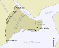
at Byzantine Empire | |
 |
at Byzantine Empire |  |
at Byzantine Empire | |
 |
at Byzantine Empire |  |
||
 |
at Operation Weserübung |  |
at Constantinople | |
 |
at Diadochi |
Historical maps
[edit] |
at Peloponnesian War |  |
at Nordic Countries | |
 |
at Operation Weserübung and others |  |
at Treaty of Nöteborg | |
 |
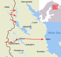
at Viena expedition |  |
at Salpalinja (VKT-line and VT-line to come.) | |
 |
at Mannerheim Line |  |
at Moscow Peace Treaty (1940) | |
 |
at Petsamo |  |
at Karelian Isthmus | |
 |
at East Karelia |  |
at Continuation War | |
 |
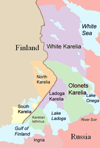
at Karelia. |  |
at Republic of Karelia, North Karelia and South Karelia | |
 |
at Treaty of Tartu |  |
at Repola (Porajärvi should be written) | |
 |
based on CIA World Factbook map of Finland. at Grand Duchy of Finland |
Finnish Provinces
[edit]Finnish Regions
[edit]
 File:North Karelia.png
File:Pirkanmaa Region.png


